
*----Table of ContentsFind geographical acronyms and codes in Geography Glossary| MORE =
*----For ggr codes, hop to Geography Glossary
0. Useful maps (EG=navigable internet maps)
1. Some Map Theory, Especially for Historians
1a. Metropols and Peripheries
1b. Moving-Map History of World Colonialism
1c. A Peculiar SAC usage = AfroAsia
2. Geographic Table for Russian Eurasia
3. Demographic Page
4. Website and other useful Maps
5. General Websites
6. Bibliography of Atlases
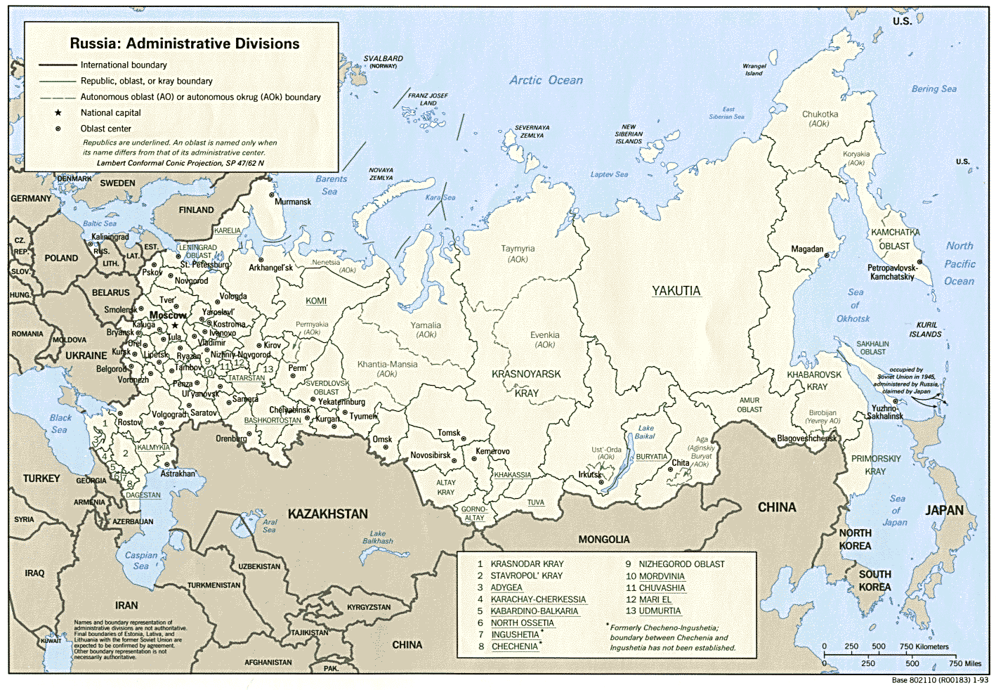
7. The 89 Regions of Post-Soviet Russia
8. Russia/America: Frontiers and Imperial Peripheries
0. INTRODUCTION = Useful maps
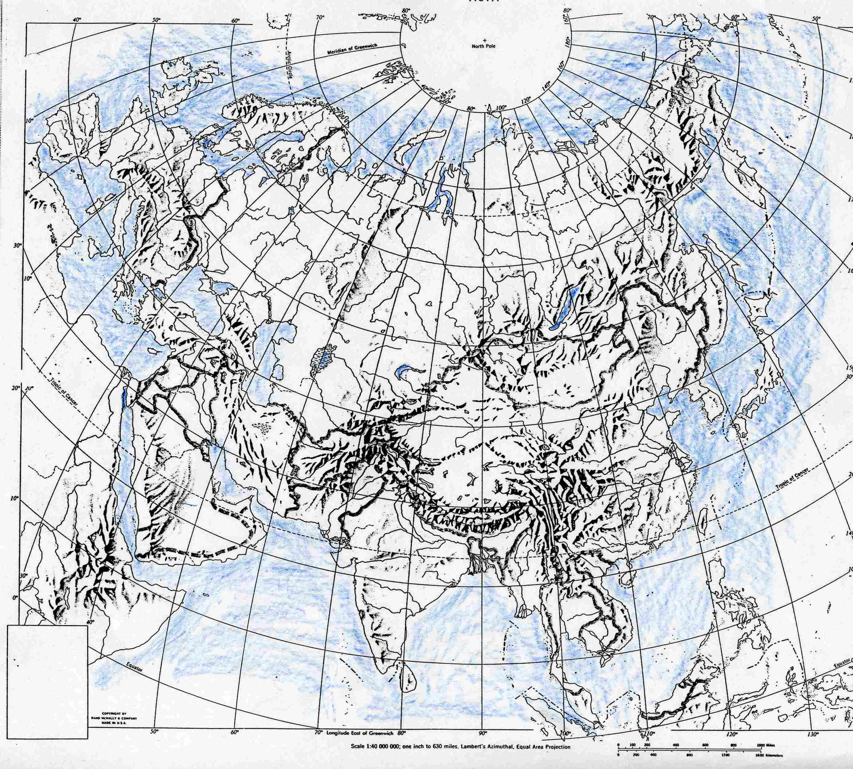
[E] = Eurasian outline
map
[EUA]
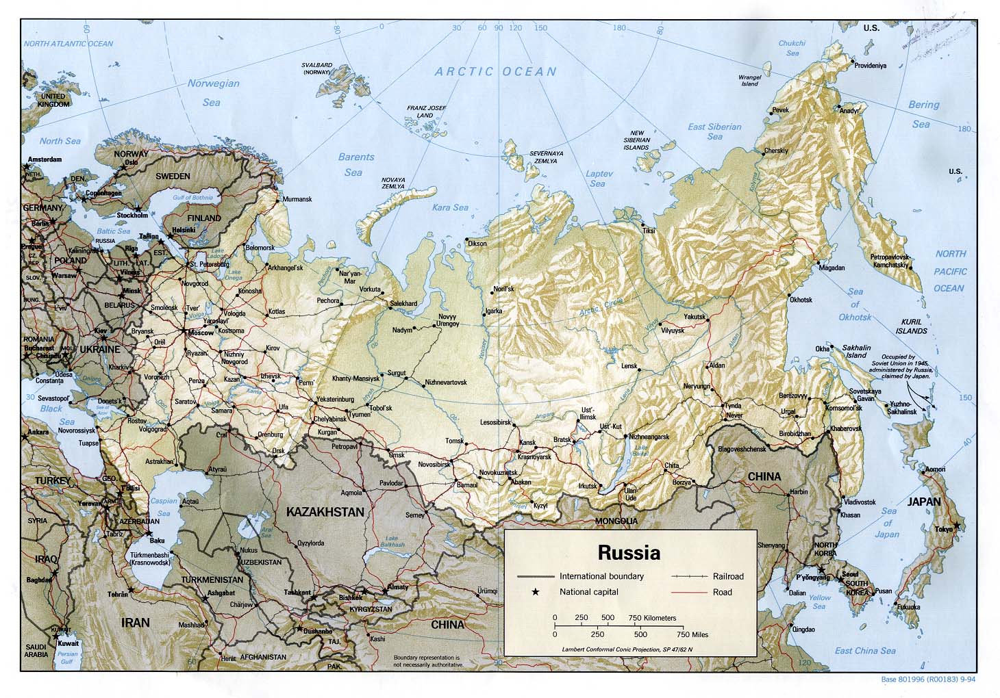
[R] =
Standard map of "Russia/USSR/Russia",
w/ topography &
political/locational labels
Snow and ice in the global northern hemisphere [ecx]
CONNECT TO GOOD NAVIGABLE INTERNET MAPS =
Google Maps Eugene OR
Google Maps Eurasia [EUA]
GoogleEarth Russia
Enter these navigable
internet maps in your web-browsing program's BOOKMARKS window,
and/or
create a permanent "tab" featuring this webpage "Geography", thus
placing these electronic maps at your fingertips
Become fluent in your use of them (it takes practice)
They allow you to zoom in or out
They allow you to move around the world, even beyond the initial opening frame
They allow you to select "satellite images" of topography or conventional flat
maps littered over with place-names
Some Map Theory, Especially for Historians
Speaking of "place-names" and the way they "litter" the face
of the good earth on most maps, we need to be careful about how we name certain
areas. Mountains have names, rivers have names, the great pools of water (lakes,
seas, oceans) have names. These names can vary among the world's many different
languages, but they tend to be distinct & reasonably stable over time. Cities
are like that too.
Larger territories, EG= "nation-states", "empires", and
vaguely prescriptive "geo-regions" [EG="The West" or "The Mideast" or "AfroAsia"
or "Europe"], bear many different names over time.
On most maps, territorial nation-state borders are privileged to wrap topography in something like webs. Prominent lines are drawn to encompass areas that are frequently even colored differently [EG], as if the nation-state were as eternal and distinct in shape and location as mountains and seas, or as a piece of tile in an elaborate mosaic floor. The problem is, over time nation-states aren't at all like tile over a stable platform. [On the philosophical question of drawing lines on MAPS [E-TXT]
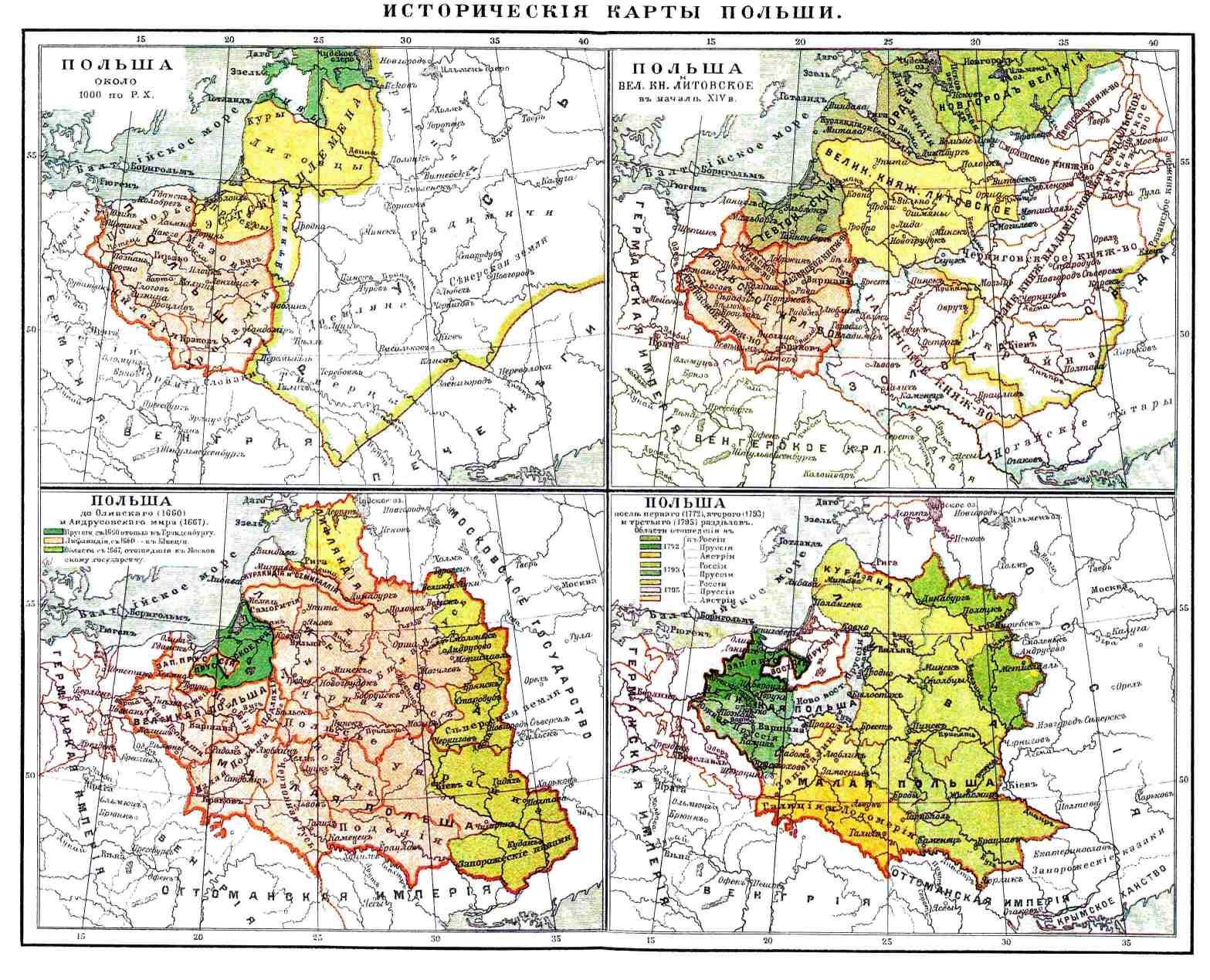
For example, trace the map history of that geo-political unit
called "Poland" [EG=The
yellow and orange plots on these four historical maps of Poland]. Poland
expands and contracts and moves all over the map of northeastern "Europe" more
like a tasty cracker floating in a bowl of soup greedily stirred by neighboring
powers than like a firmly laid tile floor.
Nation-states are misleadingly abbreviated in colloquial usage as "nations".
Technically, "nation" is not a geographic term. It is a demographic term.
Demography is the study of populations. Demography can sometimes locate on maps
identifiable varieties of peoples characterized by shared ethnicity and cultural
traits like language and other forms of traditional behavior. A big part of
those people called "Poles" have over the centuries lived just outside the
borders of the territorial units called "Poland". Much history follows from the
fact that Poles often didn't like this situation.
And remember that most nation-states (the geo-political term) are comprised of many different
nations (culturally or ethnically differentiated peoples, a demographic term). In modern
historical times, Russia has been an empire, later a republic within the USSR, and now a distinct
nation-state, the Russian Federation. Russia the nation-state has generally put its borders around
several score different ethnic nations, of which Russians, as a percentage of the over-all population,
fluctuate around 50% [EG].
Russia is the largest nation-state on the face of the globe, and it forces us to re-think the geophysical
feature we call the "continent" of Europe. Consider this long road trip = 2016jy09: "German team drives
VW Touareg 15,000km from Magadan [ID] to
Lisbon [ID] in record 154
hours" [that's 8,830 miles, twice as far as from Anchorage to Miami]
[E-TXT of www.rt.com article]
USA is a nation-state with borders around 50 "states" and around many different
ethnic nations [EG]
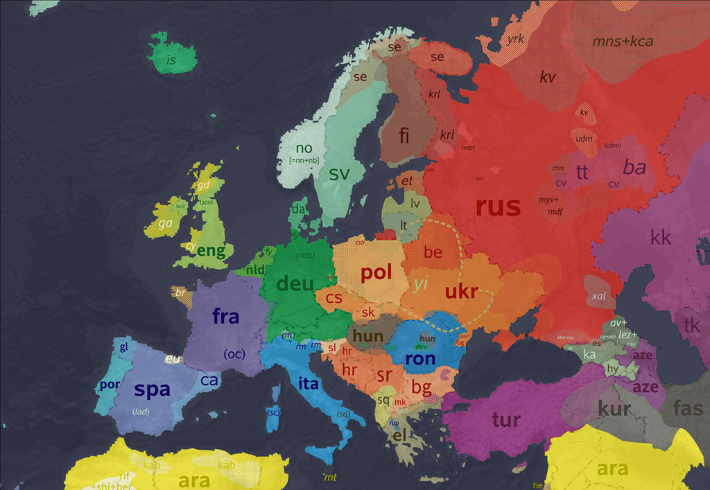
Think also about "Germany" [Deutschland]. There was no nation-state
Deutschland until 1871. Germans lived and still live in many different European
places not within the nation-state Deutschland. Notice how the colored
space representing language groups spills over the faint dash-lines or webbing
indicating nation-state borders
on this map.
Thus we have to be alert to the fluid nature of borders, and especially of
"frontiers". Most of known history has had people abutting and overlapping one
another along frontiers rather than borders.
We do better to rivet our most fixed geographical knowledge to high points
(mountains and high plateaus), low points (seas and oceans), the waters between
the high and low points (rivers, lakes, reservoirs, canals), and the
semi-permanent clusters of peoples in cities. Cities, most notably the great
metropol centers, are reasonably stable in name
[CF= Geographic Table below]
For a fresh look at the meaning of maps, check this website =
“The
Map as Cultural Assumption”
Here is a suggestive article about hand-drawn maps [2006mr-ap:VIA:37
=TXT]
Metropols and Peripheries
Throughout most known history, the geographic center of state
power has been in great ruling cities. These big cities may be called
"Metropols" (aka Metropoles or "Cores" )
Here is a table of world's largest cities over the centuries
[E-TXT]
Watch this moving-map video as the world's cities appear over a 6,000-year period| The Guardian
[VIDEO]
In the epoch historians call "modern" (IE=since trans-oceanic transport became practicable ca. 1600),
urban-centered command-and-control power has been regularly projected beyond metropol outskirts, beyond borders
of sovereign nation-state authority into wider geo-regions of the world. Here is a
hop that gives the
long-duration background to this modern historical trend. And at the same time
the hop reminds us that urban-centered command-and-control power since that same
time has also been exercised with new vigor within sovereign nation-state
borders.
Metropols project their sovereign power outward toward what may be called "Peripheries",
toward geo-regions that can be either close to or far away from these urban power centers,
either within or beyond nation-state borders.
The geographic terms "metropol" and "periphery" used here are derived from
"World System" theory [ID].
Among world-system theories, SAC places unusual emphasis on three aspects of the
question, (1) the distinction between "Imperialism and "Colonialism", (2) the
distinction between metropol-periphery relations within domestic political
borders and those beyond nation-state borders [*2016:| Etkind,Aleksandr|_Внутренняя
колонизация: имперский опыт России], (3) the importance of "asymmetric war"
in both international and domestic projection of metropol power.
As for point #1, the two terms "imperialism" and "colonialism"
are often conflated. In recent times, historians have used the term
"Settler Colonialism" to de-link or at least bring some distinction of terms in
the study of imperialism and colonialism.
Settler Colonial studies encourage transnational comparative understanding, a
"focused world history" of a distinct form of imperialist domination, a
particular sort of metropol projection into the periphery. Serious study began
with *1989|>Wolfe,Patrick|_Settler Colonialism and the Transformation of
Anthropology
The most important set of questions about "settler colonialism" raised in SAC
are in connection with USA and Russian frontier and imperialist expansion into
contiguous peripheries [TXT]
Here in SAC, as we explore the geographical realm of historical experience
[ID], let's try to make a simple and far-from-absolute de-linkage of
"imperialism" from "colonialism" = Imperialism means projection outward of
central state power in pursuit of advantage to that central state power.
Imperialism can take the form of state-sponsored colonial settlement beyond
sovereign state borders. But colonialism can be the result of more spontaneous
movement of migrant peoples beyond original state borders into other
territories, in pursuit of advantage to the colonists themselves. Both of these
forms cause problems, as in the case of 19th-c Euro-Americans' movement into and
seizure of Native-American lands in the 19th century, or "illegal aliens"
crossing the border into El Norte in the 21st. Still, the historian has
to see that most instances of colonial imperialism has involved some form of
metropol sponsorship, encouragement or supportive tolerance.
This is so even in our more recent period of "transnational corporations". Most
globalized economic enterprises are very thoroughly integrated with state power.
In this regard there are differences between, say, the 19th-century Russian
America Company [ID] and 21st-century
Halliburton [ID].
But does this difference suggest a new era of imperialism in our time, or simply
a re-emergence of early-modern 16th-century mercantilist imperialism [ID
tempts you beneficially to take several hypertext hops on the key morpheme
"mercantil"].
As for point #2, World System theory works as well for domestic political
conflict (revolution) as it does for interstate conflict (war). SAC presumes
that war and revolution are nearly indistinguishable. One is "international war"
and the other is "domestic war" [EG].
As for point #3, wars and revolutions grow out of international and/or domestic imbalances of power between nation-states and/or social groups. For now, just let me suggest that the 19th-century concept of "balance of power" as a regulator of interstate relations and the 18th-century concepts of "checks and balances" [ID] and "sovereignty" [ID] as regulators of domestic political relationships both work to prevent development of "asymmetric warfare" abroad and at home.
Two cartoons capture the shared international and domestic
political significance of this idea =
Cartoon #1 and
cartoon #2
Moving-Map history of World
Colonialism [imperialism],
1492-2008
Color-coding identifies the most important waxing and waning imperialist
"nation-states" and their colonial peripheries,
seven at first, growing by 1885 to thirteen
Even before you open the moving MAP, here is some help from SAC to get a better
grasp of
the map's eleven time periods and the
several metropols (not all "European") and
their many peripheries =
Period #01 *1492 [ SAC#1 | SAC#2 | SAC#3 ] Metropols = England, France, Spain, Portugal, Russia, Ottoman Empire (Turks), Denmark
Period #02 *1550 [ SAC#1 | SAC#2 ]
Period #03 *1660 [ SAC (3 hops on "New World" LOOP) ]
Period #04 *1754 [ SAC (2 entries) ] Metropols = add Netherlands to the list of expansive nations
Period #05 *1822 [ SAC#1 | SAC#2 (2 entries) | SAC#3 | SAC#4 | SAC#5 (long "Great Game" LOOP) ] Metropols = add USA
Period #06 *1885 [ SAC#1 ("Iran" LOOP) | SAC#2 | SAC#3 | SAC#5 ] Metropols = add Belgium, Italy, Germany and Japan
Period #07 *1914 [ SAC#1 | SAC#2 | SAC#3 |SAC#4 | SAC#5 | SAC#6]
Period #08 *1938 [ SAC#1 | SAC#2 | SAC#3 | SAC#4 (2 entries) | SAC#5 (6 hops on the "AfroAsia" LOOP to 45se13) | ]
Period #09 *1959 [ SAC]
Period #10 *1974 [ SAC]
Period #11 *2008 [ SAC]
The map moves automatically through those eleven time periods
The full half-millennium cycle takes only one minute
It is therefore very difficult to "take it all in"
I recommend you pause and ponder the video at each of the eleven time periods
Choose one of the areas, either metropol or periphery, and run through the
eleven periods with concentration on your choice
Here is the moving MAP of
World Colonialism [imperialism]
Into the 21st century, the conduct of imperial or nation-state
diplomatic affairs was and still is frequently identified as the relationship
between great ruling cities. When Great Britain (an empire) negotiated with
Hitler Germany (also an empire, a Reich), it was frequently described as
London negotiating with Berlin. The two metropols, these two centers of
executive political authority (government), were negotiating their relationship
with one another. At the center of attention were perceived overlapping
"national interests" of these metropols, competition and conflict in claimed or
desired peripheries.
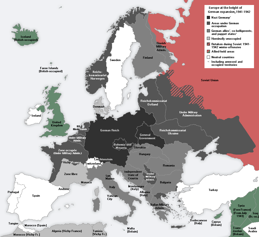
The peripheries of that north German metropol Berlin expanded dramatically in
WW2, and the peripheries of London shrank. SAC editor is in possession of an
envelope stamped in 1939 from "Wien, Deutschland" [Vienna, Germany]. The
Austrian metropol, Vienna, once the capital of the Holy Roman Empire, became a
periphery of the north German metropol, Berlin. Vienna and Berlin have always
been where they are, but a German empire was created in 1871 and centered in
Berlin, then expanded tragically in WW2 [MAP],
was greatly reduced and broken into four parts after 1945
[ID], consolidated quickly as two nation-states
[ID], and in 1989, as the Soviet empire disintegrated, Germany reunited as
one [ID]. Briefly marvel at these shifting
maps of the British Empire.
With all the larger place-name instability, the Rhine and Danube rivers [ecx]
just kept flowing along out of the Alps highlands. The Rhine flows into North
Sea marshes where the Netherlanders live (wrongly but inalterably called "the
Dutch" by English-speakers). The Danube flows through Austria [Ostreich
or Eastern-empire] and into the Black Sea. The Danube River flows through
diverse lands called "the Balkans" (a mountain chain that runs along the right
bank of the big river). These are the lands of peoples whose histories were so
often the histories of folks who live at the periphery of foreign great power
metropols. EG=LOOP
on "Yugoslavia" -- just a few hops will do -- to get a sense of how the
metropols Vienna, Istanbul, Saint-Petersburg [Russia], and other powerful but
remote metropols (EG=London and Paris)
vied with one another for advantage there.
By the way, the word "Dutch" is an English corruption and misapplication of the
German word for "German" [Deutsch]. The "Pennsylvania Dutch" are not from
Nederland or Holland but from north central European German-speaking
territories. "Yugoslavia" is simply the Slavic way of saying "the land where
South Slavic peoples live", but then in recent decades we learn that the borders
of Yugoslavia were drawn around many other sorts of people, some of them not
Slavs at all
[EG].
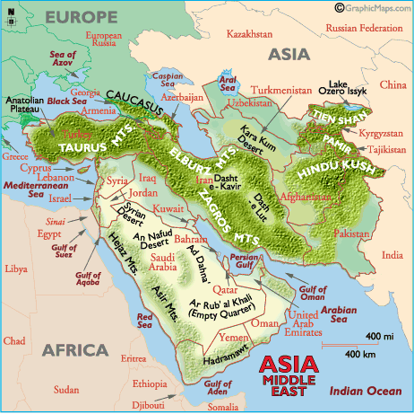
We can feel very confident of geo-political terms like Mediterranean Sea,
Damascus, Tigris and Euphrates, Volga, Mississippi, Hindu Kush
[MAP-center-right].
But we must remain provisional in our use of terms that identify and try to
distinguish large, shifting, indistinct and overlapping geo-regions =


GEOGRAPHIC TABLE:
Russia
and its "Near Abroad":
HIGH POINTS, LOW POOLS,
THE WATERS THAT FLOW BETWEEN,
CONCENTRATED POPULATIONS (CITIES),
& OTHER FEATURES
In the table below, the central organizational principle,
defining each row at column 2, is
the river
On any row, from column one (far left) to column five
(far right), you take an imaginary river trip from highlands to various
seas,
from the high points to the low pools.
Obviously an imaginary river trip works best if you
have a map at hand
or use the hypertext links to maps in column 5
to
give spatial identity to the imaginary river trip
Column 1, High Points and the rivers that flow from
them, explained =
The six most important high points, with their most
important watersheds (entered here roughly SW to NE) are =
1) Caucasus Mts. (Mt. El'brus = 18,500)
GO Kuban and Kura rivers
2) Valdai Hills (1138 ft., this the highest spot in European Russia)
GO Dnepr [rises 830 ft above sea level], Vistula, Western.Dvina, Velikaia, Volkhov, Volga [730 ft.]
3) Ural Mts. (Urals; 6214 ft maximum height in the far north; few points above 4000 ft.
The Trans-Siberian Railroad crosses the Urals at 1345 ft. Mt. Tom in the Coburg Hills = 3100 ft.)
GO [Pechora], Kama, Ufa, Ural, Northern Dvina, Tobol, and Tavda rivers
4) Tien Shan Mts., divides China's Sinkiang border from Central Asia (Mt.Communism = 24,600)
GO Amu Darya, Syr Darya, Ili rivers
5) Lake Baikal (6365 ft. deep) and the western slopes of its high west bank
GO Angara and Lena rivers
6) Altai highlands of western Mongolia (15,266 at highest peak)
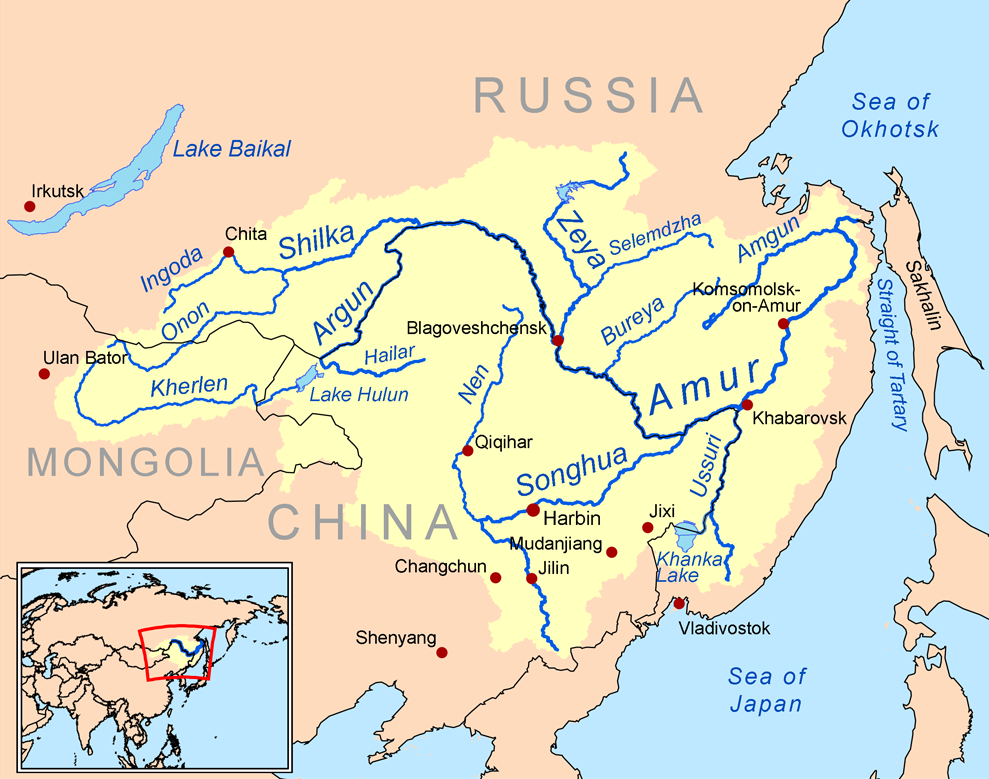
GO Ob - Irtysh [not unlike forked Missouri - Mississippi], Yenisei, Amur, Argun and Shilka riversColumn 2, Rivers, explained =
The table as a whole features 27 Eurasian river systems, their origins, course and destinations
There are 17 rivers (top 17 rows) in what is called "European Russia"
This includes some rivers in non-Russian territories which have been frequently in the orbit of Russian power.Column 3, Cities, explained =
Most of the cities here are located along rivers
But NB! a small number of mountain cities [bracketed in column 1]
And coastal cities [bracketed in column 4]Column 4, Low Pools & other features
Column 5 explained =
Alpha-coded to identify the seven major low pools =A = Black Sea
B = Caspian Sea
C = Baltic Sea
D = White Sea
E = Aral Sea [ecx (with excellent and generally very wise comments by Nils Anders Lunde) ]
F = Arctic Sea [or Arctic Ocean], and
G = Sea of OkhotskThe first four low pools (A-D) are the destinations of what we conventionally call "European" rivers
The last three (E-G) are "Asian" (Siberian)
Notice how a number is attached to each alpha-coded drainage region to specify individual river systems
EG=The great Volga River is in the (B) Caspian Sea region and is coded "B1".
Column 5 also contains hypertext hop-points =[m] = Regional map of the given low pool
[E] = Eurasian outline map
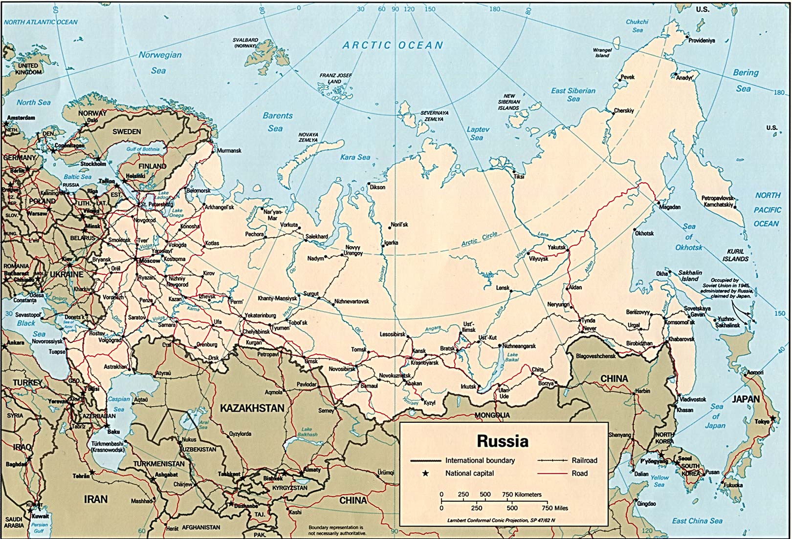
[R] = Standard map of "Russia/USSR/Russia", w/ topography & political/locational labels
[G] = GoogleEarth map of Eurasia with powerful but difficult exploration featureThese maps facilitate imaginary river trips,
a good way to gain mastery over this river-centered table of Russian and northern Asian geography
Here in river-city Eugene, river consciousness is a mind-expanding experience.
1. High Points
(w/alt. in feet)2. Rivers
3. Cities*
4. Low pools
& other features5.Code
&maps
DanubeVienna (OST)
Bratislava (SLO)
Budapest (HUN)
Belgrade (SRB)Black Sea with its tight straits (Dardanelles & Bosporus) flowing southwestward into the
Aegean & Mediterranean Seas,
past the great city
Constantinople/Istanbul
A1
[m]
[E]
[R]
[G]Carpathian Mts. (N) Poland Slovakia
Dnestr
A2
[m]
[E]
[R] [G]Valdai Hills
1138 ft.
Dnepr
830 ft.A3
[m] [E]
[R] [G]Steppes of Central Eur-Rus
DonSea of Azov
Black Sea
[Novorossiisk]A4
[m] [E]
[R] [G]Caucasus Mts.
Kuban
Black SeaA5
[m] [E] [R] [G]Valdai Hills
Volga
730 ft.Tver [map] [map]
Yaroslavl [map] [pix]
Nizhnii-Novgorod [map]
Kazan [W]
Saratov
Volgograd [map] Astrakhan [map]Caspian Sea
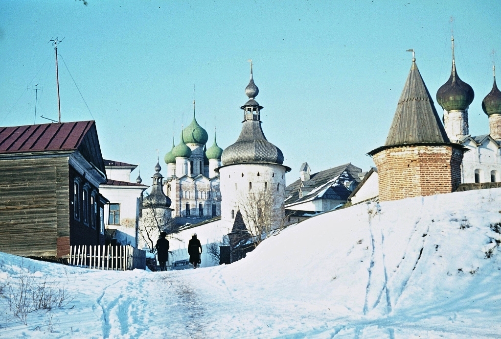
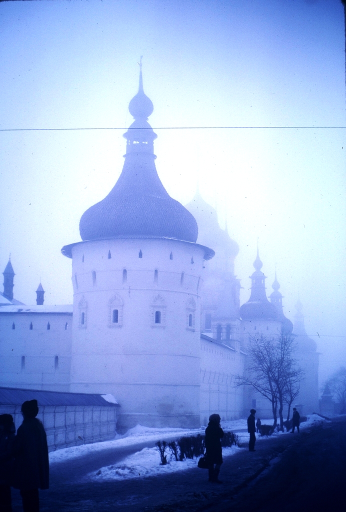
[ Baku] [map]Rostov Velikii [pix] [pix] [pix] [pix]
Valdai & north Volga =
South Volga &Caspian=B1
[m]
[E]
[R]
[G]Valdai Hills
Oka, etc.
VolgaB2
[m] [E]
[R] [G]Urals,
west-central
Kama etc.
VolgaB3
[m] [E]
[R] [G]Urals,
west-central
UfaUfa
Kama RiverB4
[m] [E]
[R] [G]Urals, south
Ural
Caspian SeaB5
[m] [E]
[R] [G]Caucasus
Kura
Caspian SeaB6
[m] [E]
[R] [G]Turkey, east. highlands
Araks
Kura RiverB7
[m] [E]
[R] [G]Valdai Hills
VistulaWarsaw C1
[m]
[E] [R] [G]Valdai Hills
Western Dvina
Gulf of Riga
Baltic SeaC2
[m] [E] [R] [G]Valdai Hills
VelikaiaNarva (port city)
Lake Peipus
Baltic Sea
Narva River
Gulf of FinlandC3
[m]
[E] [R] [G]Valdai Hills
Volkhov
Lake LadogaC4
[m] [E]
[R] [G]Ladoga, Lake
NevaSt.Petersburg
Gulf of Finland
Baltic SeaC5
[m] [E] [R] [G]Urals, west-central
Northern DvinaArkhangel'sk [map]
White Sea
Berents Sea
[Murmansk (map)]
North Sea
Atlantic OceanD1 Tien Shan Mts.
Amu Darya
Aral Sea
pixE1
[E]
[R]
[G]Tien Shan, Fergana Valley
Syr Darya
Aral SeaE2
[E]
[R] [G]Tien Shan Mts.
Ili
Lake BalkhashE3
[E]
[R] [G]Altai highlands
ObARCTIC SEA
Novaia Zemlia IslandF1
[E]
[R] [G]
Tobol
Arctic Sea
F2
[E]
[R] [G]Urals, central-east
Tavda
Arctic Sea
F3
[E]
[R] [G]Altai
IrtyshArctic Sea
F4
[E]
[R] [G]Altai
YeniseiArctic Sea
F5
[E]
[R] [G]Baikal, Lake
AngaraYenesei River
F6
[E]
[R] [G]
Tunguska
Yenesei River
F7
[E]
[R] [G]Baikal Lake, 20 miles from W. shore
LenaArctic Sea
Verkhoyansk Mts.F8
[E]
[R] [G]Yablonovyi mts.
Vitim
Lena River
F9 Stanovoi mts.
Aldan
Lena River
F10
[E]
[R] [G]Kolyma range
KolymaKolyma
Arctic Sea
F11
[E]
[R] [G]Altai highlands (Eastern Mongolia)
Amur | The final 4 rivers on this table flow into Amur [MAP#1 MAP#2]
Tartar Gulf
(Sakhalin Island)
Sea of Okhotsk [Okhotsk City]
[Magadan] [map]
Kamchatka Peninsula
Kuril Islands
Aleutian Islands
Bering Sea
(Sea of Japan
Japanese Islands)
Pacific OceanG1
[E]
[R]
[G]Altai (above)
Argun
Amur RiverG2
[E]
[R] [G]Altai (above)
Shilka
Amur RiverG3
[E]
[R] [G]Sungari
Harbin (Manchu China)
Amur RiverG4
[E]
[R] [G]Korea, China
Ussuri
G5
[E]
[R] [G]MAPSITE and OTHER USEFUL MAPS
Russia |---| Eurasia outline |---| Northern Hemisphere Snow & Ice Charts
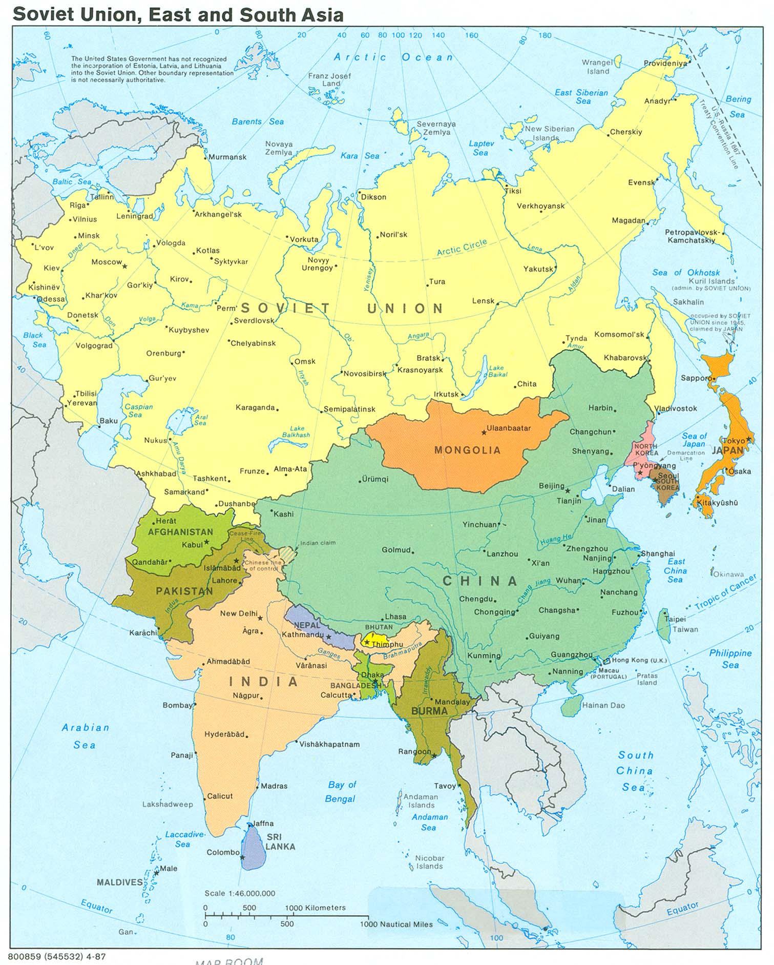
Global tetrahedral |---| USA.CIA maps |---| Interactive map centered on DjiboutiImperial Russian Maps and Digital Peasant Project
Old Map of Russian Empire, with "Zoom"
Geography of the Russian Empire, province [guberniia] by province
Russian genealogical resources, with maps
- GoogleEarth -- click to tighten fist and drag yourself anywhere in the world
- UNO maps
- UO map (atlas) website
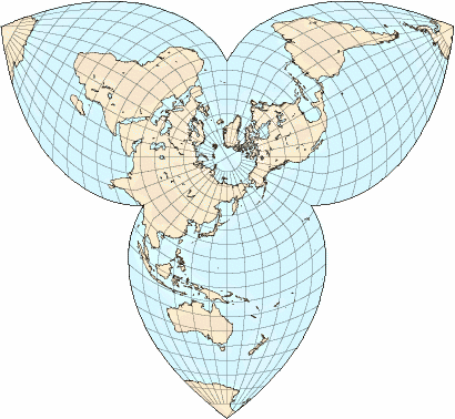
- Global tetrahedral projection
- North-polar projections of Cold War globe
- World soil map [ecx]
- Eurasia, growth of "civilization" to 200 BC [EUA]
- North, East and South Asia [EUA]
- Eurasia (without far-western Europe) [CIA] [EUA]
- Excellent Free Blank Map of Eurasia, showing nation-state borders [EUA]
- Fallingrain Regions of Russia | Here is a post 1993 list of administrative regions
- 1914:Russian Administrative regions
- One of the best collections of maps of Russian-centered Eurasia [EUA]
- A set of historical maps of Russia and Eurasia, with places labeled [EUA]
- Russia, geo-physical and political (with rail lines)
- R=BIG MAP OF RUSSIA; Ditto
- Snow Today on the Northern Hemisphere [ecx]
- Permafrost of the Northern Hemisphere [ecx]
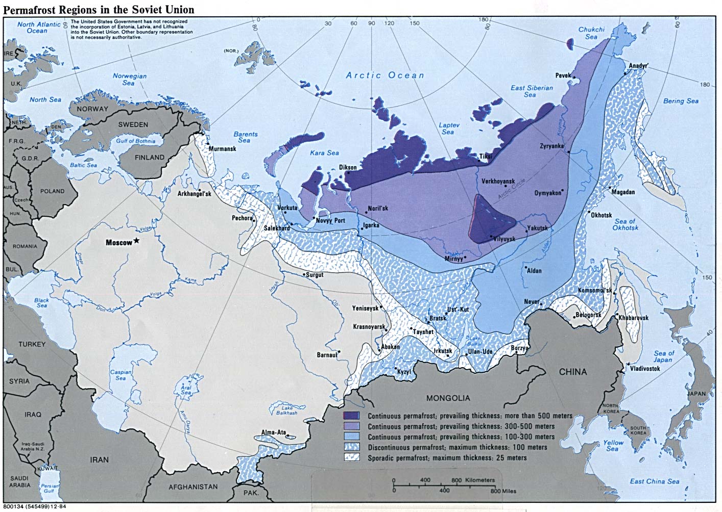
- Permafrost in Russia [ecx]
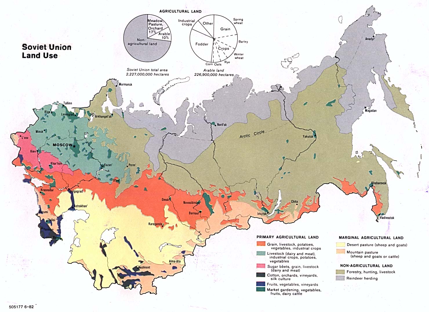
- Vegetative zones of Russia [ecx]
- 2002:Caspian Sea Pipelines
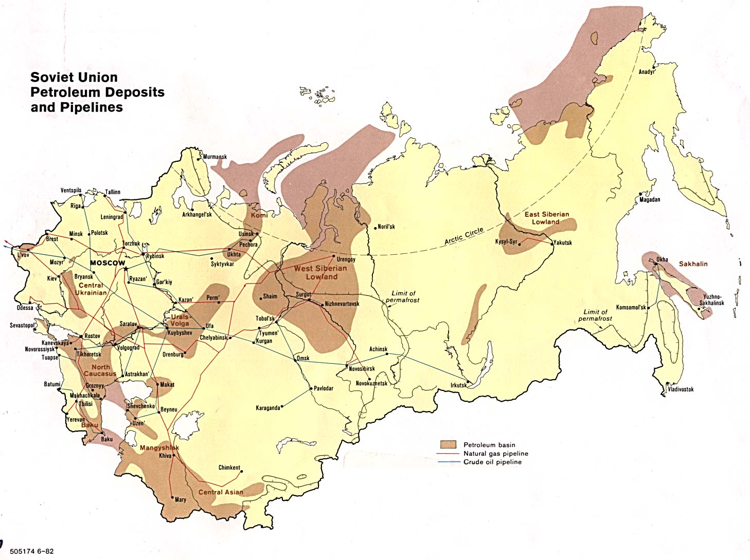
- Petroleum deposits and pipelines (dated)
- Russian national parks and preserves
- Areas of key environmental problems (Adobe); Ditto (not Adobe) [ecx]
- Area Studies, country by country
- USA at night
Here is a list of the 89 federal units of Russia in order of population according to the 2002 census
This list contains some comments from www.economicexpert
- Moscow 10,382,754
- Moscow Oblast 6,618,538
- Krasnodar Krai 5,125,221
- Saint Petersburg 4,661,219
- Sverdlovsk Oblast 4,486,214
- Rostov Oblast 4,404,013
- Bashkortostan 4,104,336
- Tatarstan 3,779,265
- Chelyabinsk Oblast 3,603,339
- Nizhny Novgorod Oblast 3,524,028
- Tyumen Oblast 3,264,841
- Samara Oblast 3,239,737
- Krasnoyarsk Krai 2,966,042
- Kemerovo Oblast ( 1995 pop. 3,077,900 est. Often called Kuzbass after the Kuznetsk Coal Basin, located in southwestern Siberia, Russia, where the West-Siberian Plain meets the South Siberian mountains. The oblast, 95,700 km², shares a border with Tomsk 2,899,142)
- Perm Oblast is in the Privolzhsky (Volga) Federal District of Russia. It is named after its primary city, Perm. The oblast covers an area of 160,600 km², and as of the 2002 census the population was 2,819,421
- Stavropol Krai is a regional subdivision of Russia. Its administrative center is the city of Stavropol. As of February 2004 its governor is Alexander Chernogorov. Administrative Division Districts Stavropol Krai consists of the following districts : Alexa 2,735,139
- Volgograd Oblast is a regional subdivision of Russia. Its administrative center is the city of Volgograd. Area 114,100 km², population 2,531,000 ( 1985). Administrative Division Districts Volgograd Oblast consists of the following districts ( Russian: ): 2,699,223
- Novosibirsk Oblast is a regional subdivision of Russia. Its administrative center is the city of Novosibirsk. Novosibirsk Oblast (area 178,200 km², pop. 2,748,500 est. 1995) is located in the southeastern Western Siberian plain, at the foothills of low S 2,692,251
- Saratov Oblast ( Russian: ) is a federal subject of Russia (an oblast), located in the Volga Federal District. Its administrative center is Saratov. Major cities include Balakovo (pop. 200,600 as of 2002) and Engels (pop. Area 100,200 km² ( ranked 36th), 2,668,310
- Altai Krai (́ ) is a regional subdivision of Russia in the Siberian Federal District. It borders with, clockwise from the south, Kazakhstan, Novosibirsk and Kemerovo Oblasts and the Altai Republic. The krai's administrative center is the city of Bar 2,607,426
- The Irkutsk Oblast Russia is located in south-eastern Siberia in the basins of Angara, Lena and Nizhnyaya Tunguska rivers, and occupies an area of 767,900 km² (4. 6% of Russia's territory). The Irkutsk Oblast borders with the Buryat and Tuva Republics in 2,581,705
- Dagestan 2,576,531
- Voronezh Oblast 2,378,80
- Orenburg Oblast 2,179,551
- Omsk Oblast 2,079,220
- Primorsky Krai 2,071,210
- Tula Oblast 1,675,758
- Leningrad Oblast 1,669,205
- Udmurtia 1,570,316
- Vladimir Oblast 1,523,990
- Belgorod Oblast 1,511,620
- Kirov Oblast 1,503,529
- Tver Oblast 1,471,459
- Penza Oblast 1,452,941
- Khabarovsk Krai 1,436,570
- Khantia-Mansia 1,432,817
- Ulyanovsk Oblast 1,382,811
- Bryansk Oblast 1,378,941
- Yaroslavl Oblast 1,367,398
- Arkhangelsk Oblast 1,336,539
- Chuvashia 1,313,754
- Vologda Oblast 1,269,568
- Kursk Oblast 1,235,091
- Ryazan Oblast 1,227,910
- Lipetsk Oblast 1,213,499
- Tambov Oblast 1,178,443
- Chita Oblast 1,155,346
- Ivanovo Oblast 1,148,329
- Chechnya 1,103,686
- Smolensk Oblast 1,049,574
- Tomsk Oblast 1,046,039
- Kaluga Oblast 1,041,641
- Kurgan Oblast 1,019,532
- Komi Republic 1,018,674
- Astrakhan Oblast 1,005,276
- Buryat Republic 981,238
- Kaliningrad Oblast 955,281
- Sakha Republic 949,280
- Amur Oblast 902,844
- Kabardino-Balkaria 901,494
- Murmansk Oblast 892,534
- Mordovia 888,766
- Oryol Oblast 860,262
- Pskov Oblast 760,810
- Kostroma Oblast 736,641
- Mariy El 727,979
- Republic of Karelia 716,281
- North Ossetia-Alania 710,275
- Novgorod Oblast 694,355
- Sakhalin Oblast 546,695
- Khakassia 546,072
- Yamalia 507,006
- Ingushetia 467,294
- Adygeya 447,109
- Karachay-Cherkessia 439,470
- Kamchatka Oblast 358,801
- Tuva 305,510
- Kalmykia 292,410
- Altai Republic 202,947
- Jewish Autonomous Oblast 190,915
- Magadan Oblast 182,726
- Permyakia 136,076
- Ust-Orda Buryatia 135,327
- Aga Buryatia 72,213
- Chukotka 53,824
- Nenetsia 41,546
- Taymyria 39,786
- Koryakia 25,157
- Evenkia 17,697
Bibliography of Atlases
EUROPE AND THE WORLD
(Russia and Eastern Europe at the bottom)
with Locations
MAP = Knight Library Map collection
REF = Knight Library Reference RoomThe most useful atlases of Russian history are listed in the GLOSSARY
<>Atlas zur Zeitgeschichte : Europa im 20. Jahrhundert
<>Cassell atlas of world history | On 20th-c world, see scts 5.05, 5.06, & all of sct 6
<>Collins atlas of twentieth century world history
<>Collins atlas of world history
<>Hammond atlas of the 20th century
<>National Geographic atlas of world history | On 20th century world, see pp. 302-79
<>Natkiel, Richard, et al. Atlas of the 20th century
<>Oxford illustrated history of modern Europe. Edited by T.C.W. Blanning
<>Palmowski, Jan. A dictionary of twentieth-century world history
<>Rand McNally Historical atlas of the world
<>Times atlas of European history | On 20th century world, see pp. 164-91
<>Times atlas of the 20th century
<>Times atlas of world history
<>Wheatcroft, Andrew. The world atlas of revolutionsRussia and Eastern Europe
Burdett, Anita L. P., ed. The historical boundaries between Bosnia, Croatia, Serbia: documents and maps 1815-1945
Landscape Atlas of the USSR | Maps #6-30 = close-ups of strategic points in Western European Russia, from Baltic shores, over the central plains, down to the Black Sea Coast. See the good outline maps, pp. 19 and 37
-------------------------------------
NORTHERN HEMISPHERE SNOW & ICE CHARTS [NOAA website]
*2004fe09:Northern Hemisphere Snow & Ice Chart
*2010fe11:Northern Hemisphere Snow & Ice Chart
*LATEST Northern Hemisphere Snow & Ice Chart2015se01:2016au31; Northern Hemisphere Snow & Ice Chart animated to show passage of whole year
|
\
RETURN TO KIMBALL FILES HOME
/
|
|
|
|
|
|
|
|
|
|
|
|
|
|
|
![[EG]](images/maps/hand-drawn.maps.jpg)
![[EG]](http://www.lib.utexas.edu/maps/commonwealth/russia_ethnic94.jpg)
.svg)
![[m]](images/map.BLA.S.i.CAS.S-Bartholomew.jpg)
![[map]](http://www.lib.utexas.edu/maps/commonwealth/odessa_map84.jpg)
![[map]](http://www.lib.utexas.edu/maps/commonwealth/kiev_ukraine_1953.jpg)
![[map]](images/maps/Tver.gif)
![[map]](http://www.lib.utexas.edu/maps/commonwealth/volgograd_1979.jpg)
![[map]](http://www.lib.utexas.edu/maps/commonwealth/astrakhan_tpc_91.jpg)
![[map]](http://www.lib.utexas.edu/maps/commonwealth/baku_87.jpg)
![[m]](http://www.lib.utexas.edu/maps/commonwealth/caucasus_and_central.gif)
![[m]](images/map.Baltic.S.rgn-Bartholomew.jpg)
![[map]](http://www.lib.utexas.edu/maps/commonwealth/novosibirsk_1960.jpg)
![[map]](http://www.lib.utexas.edu/maps/commonwealth/omsk_1979.jpg)
![[map]](http://www.lib.utexas.edu/maps/commonwealth/khabarovsk_1978.jpg)
![[map]](http://www.lib.utexas.edu/maps/commonwealth/magadan_1978.jpg)
![Eurasia (without far-western Europe) [CIA]](http://www.lib.utexas.edu/maps/middle_east_and_asia/asia.gif)