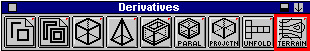
3. Select the lines in order starting with the lowest contour, then double click on the TERRAIN tool.
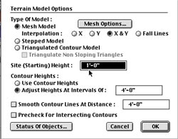
5. Under CONTOUR HEIGHTS, select ADJUST HEIGHTS AT INTERVALS OF: 4'-0".
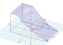
6. Now select the rectangle, and a contour model will be generated.
BACK / INDEX