The Willamette Valley: Past and Present
Geologic History of the Willamette River Basin
About 50 million years ago the Siletzia Island Chain formed when a hotspot deep beneath the Pacific Ocean generated a string of shield volcanoes, some as wide as 30 miles at the base. Some 38 million years ago, the plate upon which they rest subducted beneath the North American Plate, collided with our continent and accreted to our coastline. Oregon's Coast Mountain Range is a mixture of ancient volcanoes and folded rock that were pushed up during this collision. As this plate descended under the continent, partial melting of the rocks deep beneath the surface forced magma upwards and created a secondary mountain range in Oregon known as the Cascades.
Mary's Peak, near Corvallis, is the highest point in the Coast Range at 4,097 feet. Mt. Jefferson stands at 10,495 feet and is the highest point in the Cascades.
The Coast Range is a combination of ancient volcanic rocks and rocks like sandstone, siltstone, and clay. These materials are highly susceptible to erosion, which is why the Coast Range is not as high as the Cascades. The erosion of these mineral-rich rocks is also one reason that the Willamette Valley has such lush farmland.
The prevalence of volcanic rocks like basalt, andesite, and pumice in a drier environment means that the Cascades experience much less erosion. The Columbia Basalts were generated by a series of massive shield volcano eruptions between 17 and 5.5 million years ago. They formed impressive layers of rock as much as 6000 feet thick and covering an estimated area of 63,000 square miles, making this one of the largest basaltic floods ever to appear on the surface of the earth.
About 14,000 years ago, as the last ice age was ending, an ice dam on the Cordilleran Ice Sheet broke and caused a wall of water from Lake Missoula to inundate eastern Washington and northern Oregon as far south as Cottage Grove. The height of this flood is estimated at 2,000 feet and movement at speeds of up to 100 miles per hour: possibly the largest flood discharge ever known. This flood stripped away topsoil in its path and deposited it here, in the Willamette Valley; yet another reason that our soil is so productive. The flood also left large chunks of foreign rock that were rafted in, still encased in glacial ice. These boulders are called glacial erratics.
Ecosystems of the Willamette River Basin
The Willamette Basin is home to a wide variety of ecosystems. Four of them can be found right around Eugene: open water, riparian bottomland forest, wet prairie, and oak savanna.
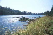
Open water supports thriving ecosystems. The Willamette River ' s channels, ponds and lakes are home to 61 species of fish, half of which are exotic or have been introduced. Chinook (Oncorhynchus tshawytscha), Steelhead (Oncorhynchus mykiss), Cutthroat (Oncorhynchus clarki) and Bulltrout (Salvelinus conluentus) are all native salmon to the area, and are in decline due to overfishing, pollution and damming. These fish are an integral part of the river's ecology, as well as an important part of the Northwest way of life. (http://www.biodiversitypartners.org/reports/Wiley/Status.shtml)
Alongside the Willamette Basin's rivers, streams, ponds and lakes, one can find another ecosystem: Riparian bottomland forest. This is characterized primarily by tree species: the Western hemlock (Tsuga heterophylla), Pacific yew (Taxus brevifolia) and Black cottonwood (Populus balsamifera). Historically, riparian forests extended approximately 5 miles out from their respective water sources. However, because the Willamette valley is heavily populated and developed, many ecosystems have been compromised. Riparian forests today may only extend a few hundred feet. Species of trees, such as black cottonwood, are declining, decreasing much of the forest's vital canopy cover, which serves as critical habitat for over 200 species of vertebrates, many of which are birds like the downy woodpecker (Picoides pubescens) and the bald eagle (Haliaeetus leucocephalus). (http://www.biodiversitypartners.org/state/or/obp/015.shtml)
Wet prairie or " wetland, " a third ecosystem, is a partially aquatic environment dominated primarily by grasses and wildflowers, such as camas lily (Camassia quamash), and Willamette daisy (Erigeron decumbem). Wet prairies are seasonal wetlands that remain saturated through winter and early spring, and dry up in the summer. Species native to this ecosystem are amphibians, reptiles and birds, such as the spotted frog (Rana pretiosa), the Western pond turtle (Clemmys marmorata) and the Great blue heron (Ardea herodias). In addition to being a critical habitat area for these and many other species of wildlife, the wet prairie ecosystem acts as a water filter and is quite important for flood control. (http://willametteexplorer.info/issues/habitats/wetland.php)
Oak savanna and upland prairie can be found on hillsides above the Willamette River. This fourth ecosystem is distinguished by groves of Oregon white oak (Quercus garryanna), grasses and flowers. There is only one percent of the original oak savanna remaining, primarily due to fire suppression. Over the years, this has caused woody vegetation, such as Douglas fir, to overcrowd the sensitive oak. This important ecosystem is home to over 250 wildlife species, including the acorn woodpecker (Melanerpes formicivorus) and the endangered Fender ' s blue butterfly (Icaricia icarioides fenderi). (http://willametteexplorer.info/issues/habitats/woodlandsandsavannas.php)
These ecosystems have been challenged greatly over the past 150 years due to agricultural and industrial development. What is left today is quite valuable to those living along the Willamette River, and many work to protect and preserve the valley's biodiversity.
A History of Policy and the Willamette
At the turn of the 20th Century and into the 1930s there existed few or no restrictions on the dumping of raw waste products directly into the Willamette River. As the poor state of the river became increasingly obvious, citizens and government officials began to realize that action needed to be taken.
In 1938 legislation was passed that formed the Oregon State Sanitary Authority (Robbins 2002). One of the Sanitary Authority's first attempts to clean up the river was the requirement of towns, including Eugene, to construct water treatment plants. In the 1940's the Sanitary Authority used many newly constructed dams on tributaries of the Willamette river to control water levels, thereby diluting pollutants and improving the water quality. Agreements were also made with local farmers and water users to reduce water usage in the summer months to keep enough water in the river to dilute pollutants (Tufts 2005).
In the 1960s the Willamette River was designated as being one of the most polluted in the nation. This precipitated renewed concern by Oregon residents over the quality of the river's water. Legislator Tom McCall, who threatened industries to clean up their acts and expanded the authority of the Department of Environmental Quality, took a leading role for action on the Willamette. In 1966 Tom McCall became Governor of Oregon and in 1967 he made a proposal for creating a Greenway along the river (Robbins 2002). This Greenway is a 150 feet buffer that starts at the banks of the river to protect the land and prevent erosion and habitat loss (Serrill 1999). The Greenway was the first piece of many land use legislations for the state. McCall was also instrumental in passing the "bottle bill" of 1971, which became the nation's first mandatory deposit and refund system on certain bottles and cans, many of which before had littered the banks of the river (Robbins 2002).
The passage of the federal Clean Water Act in 1972 was also helped improve the river water's quality. The CWA requires that studies be done on all water bodies in the state to make sure they meet water quality standards. Study results for the Willamette around the Eugene and Springfield area required the construction of a new wastewater treatment facility. This new facility, shared by Eugene and Springfield, opened in 1984 (MWMC 2006).
Senate Bill 100 passed in 1973 established the Department of Land Conservation and Development (DLCD) as well as a commission on land conservation and development. These were the first major land use regulations for Oregon that established goals for maintaining land as well as responsible development along the river. In 1975 the Oregon DLCD outlined nineteen land use planning goals for the state. Goal 15 was specifically for the Willamette River Greenway. The goal was, "To protect, enhance, and maintain the natural, scenic, historical, agricultural, economic, and recreational qualities of lands along the Willamette River as the Willamette River Greenway" (DLCD 2006). As a result of the Greenway program, by 1997 there were over 175 state parks and refuges along the river (Tufts 2005). In 1998 the Willamette became an American Heritage River.
In early March of 2004 Governor Kulongoski announced a plan to clean up the entirety of the Willamette River, which he called the Willamette River Legacy. His three main goals are to restore, repair, and recreate the quality of the river. His focus is to work with local community members, watershed councils, landowners, and other organizations to formulate action plans for water quality improvement. Repair includes working on the permit system for substances that enter the river. Restoration goals include the diverse ecosystems that surround the river such as wetlands, oak savannas, and riparian area. Recreation includes establishing the river as a scenic and recreational spot for Oregonians and tourists alike (State of Oregon website 2006).
Damming the Willamette
The presence of dams on the Willamette River and its tributaries has been a controversial issue since the creation of the first hydroelectric facilty on Willamette Falls in Oregon City in the late 19th century. The purpose of this dam and others like it is to provide the expanding urban populations with cheap and plentiful electricity. Compared with dams built after the 1940s, these early dams were relatively small and had less of a significant impact on the environment.
Dams built during and immediately after World War II were constructed to be multi-purpose facilities. They were designed to not only generate power, but also to control flooding, improve water quality, facilitate transportation and provide recreation. Seen as beacons of modernization and progress by the expanding urban populations, many were quick to overlook possible environmental consequences.
These consequences are seen directly in the rivers. One obvious consequence of dams is that they create a major physical barrier to migratory fish. They also affect the quality of the water for the fish in relation to temperature, a variable when changed can be very harmful to most fish populations. Most dams increase or decrease the water temperature down stream depending on the depth that the water from the resevoir is drawn. The building of dams also removes vegetation along the riverbank which allows sunlight to heat the water. This removal also makes the banks more susceptible to erosion, a transformation which is also aided by the dams blocking of silt which would replace that which is washed away.
Pollution in the Willamette River
The waters of the Willamette River have been severely degraded since the early 1900's due to urbanization, damming, large scale agriculture and industry. Since then, there have been many efforts to clean up the river but its waters still pose a toxic threat to many kinds of aquatic life and humans (Willamette Riverkeeper, 2006).
There are many pollutants that plague the river today; these include nutrients, pesticides, polychlorinated biphenyls (PCBs), volatile organic compounds (VOC's), temperature, bacteria, dioxins and metals.
Nutrient and pesticide pollution occurs mainly in agricultural areas along the river and its tributaries. Nutrient pollution is caused by fertilizer runoff and erosion of soils saturated with nutrients from fertilizers. Although nutrients such as nitrogen and phosphorous are naturally abundant in plants, in high levels they can lead to eutrophication of streams whereby large algal blooms dangerously reduce the oxygen content available to aquatic life. Nitrates can also be harmful to humans at high enough levels in drinking water (Wentz, 1998).
Pesticide pollution occurs when pesticides find their way into the water from agricultural soil erosion and runoff. Some of the more toxic pesticides, for example the organochlorine pesticides such as DDT, can lead to multiple health effects in humans and animals (Wentz, 1998). Their high toxicity is due in part to their persistence in the environment and their ability to bioaccumulate in the tissue of animals. Their presence can result in cancer, reproductive and developmental problems in animals and humans (Breast Cancer Research Fund, 2006). A study conducted by the United States Geological Survey from 1991-1995 found that levels set to protect aquatic life from chronic toxicity were exceeded by 10 different pesticides in the Willamette Basin (Wentz, 1998).
Polychlorinated biphenyls (PCBs) and the volatile organic compounds (VOCs) are common pollutants found in urban areas. PCBs were used in the fluids of transformers and capacitors in electrical equipment for many years before they were found to be highly toxic and were banned in the late 80's. They still find their way into the river after leaking out of old electrical equipment in industrial areas and mines (Wentz, 1998). PCBs have been shown to cause cancer in animals and cause multiple nervous, endocrine and immune system effects in animals and humans (EPA, 2006). In 2004 a fish advisory was listed warning against the consumption of fish in the Portland Harbor due to high levels of PCBs.
VOCs originate from certain chemical solvents and fuels, as well as vehicle and industrial emissions which are atmospherically deposited. At high levels of exposure these chemicals have been linked to many human health effects including possibly cancer (MDH, 2006).
Mercury is one pollutant that at its current levels in the Willamette is in violation of water quality standards (Willamette Riverkeeper, 2006). Mercury is a highly toxic metal that is also persistent and bioaccumulative in the environment. It has been linked to severe health problems in humans such as brain damage, kidney damage, birth defects and developmental problems. Pregnant women and children are the most vulnerable since mercury can be transmitted to the developing fetus through the mother's diet and to the nursing child through breast milk. The primary means of human exposure to mercury is through fish consumption since mercury tends to build up in high levels in fish. High levels of mercury in Willamette river fish have lead the Department of Human Services to issue several advisories against the consumption of fish: 1993,1997a, 1997b, 2001, 2004a, 2004b (DEQ, 2003).
The human caused sources of mercury pollution include emissions from manufacturing, industry and power generation, waste water treatment plants, historic use of fungicides containing mercury, and consumer waste that contains mercury such as thermometers. One significant point source of mercury pollution in the Willamette is the abandoned Black Butte mercury mine which has lead to very high levels of mercury pollution in the Cottage Grover reservoir downriver from the mine (DEQ, 2003).
Dioxins are some of the most toxic chemicals know to man. They are persistent and bioaccumulative in the environment and can lead to cancer, hormone disruption, and reproductive and developmental complications in humans and animals. Most human exposure to dioxins comes from consumption of animals and animal products containing dioxins in their fats. Like mercury, freshwater fish are a particularly significant contributor (EPA, 2003). Sources of human caused dioxin pollution include municipal, hospital and industrial waste incineration, sewage treatment plants, pulp and paper mills, and fuel combustion. The same United States Geological Survey study conducted from 1991-1995 on the Willamette found dioxins in all of their sediment samples taken throughout the Willamette basin. This was mostly consistent with national background levels due to atmospheric deposition from incineration and combustion, but levels were found to be much higher in industrial areas. Fish samples taken in the same study found lower overall levels of dioxins than sediment but greater concentrations of the more toxic dioxins (Wentz, 1998).
Luckily for the Willamette River and the many plants and animals that share it, there are many remediation efforts underway to restore the health of its waters. The Oregon Department of Environmental Quality is working on establishing Total Maximum Daily Loads for mercury, bacteria and temperature pollution. Their aim is to reduce the levels of these pollutants so that the river is once again safe for fishing and recreation (DEQ, 2003). Also, the Environmental Protection Agency is working to clean up the six miles of the Portland Harbor which they listed as a superfund site in 2000. They are making headway in removing large amounts of sediment contaminated with tar and creosote (EPA, 2005). Moreover, there are several non-profit organizations such as Willamette Riverkeeper working on restoration projects as well as pushing governmental agencies for action. Hopefully these combined efforts will result in a healthier and safer Willamette River for all in the near future.
From Camas to Filberts: Willamette Valley's Agricultural Bounty
In 2006 the Willamette Valley no longer greets the spring with the overwhelming purple of Camas and brilliant yellow of Tarweed. The hills are no longer blackened and charred in the late summer and the river does not span miles in winter floods. The Willamette River 200 years ago told a story of constant shifting that created a mosaic of habitats and edges. The variability of habitat supported a vibrant diversity of plant and animal life that could be utilized as food resources by the Kalapuya people of the Valley. While remnants of these ecosystems are being actively restored and protected, we have lost most of the wetlands, grasslands, savanna, gravel beds, wet prairie, riparian lowland forest, oxbow lakes, hidden side channels and wide meanders that characterized the Willamette Valley before fire suppression, damming, channelization and bank stabilization projects. Who were the Kalapuya who lived along this other Willamette and how did they use the land?
The inhabitants of the Willamette Valley Pre-Euro American contact are known today as the Kalapuya, a name for 'long grass' that was adopted by the Euro-American Settlers for the groups they encountered along the Willamette (Sinclair, 2005). The Kalapuya were not a tribe, but instead comprised a number of autonomous groups. Each village had its own head and inhabited a different watershed or tributary of the Willamette and spoke a different dialect of one of three main language groups (Cheatham 1988).
The Willamette Valley was densely populated for thousands of years. One estimate puts the number of Kalapuya in the Willamette Valley in 1770 at between 15,000 and 20,000. The population was ravaged by smallpox, venereal disease, diptheria, influenza and measles and by 1870, 100 years later, the number of Kalapuya left in the valley was estimated to be less than 100 (UO Natural History Museum). Settlers pressured the Federal government to move Kalapuyans off of any productive land that they inhabited. A first round of treaty negotiations began in 1851 and eventually after a few violent attempts at movement and broken treaties, the remaining Kalapuya were relocated along the coast as part of the Grande Rhonde and Siletz federation.
The decline of the Kalapuyans was so drastic and the racism of most of the settlers so ingrained that little accurate oral or written history was recorded until most of the population had been lost. Along with the loss of cultural heritage came major environmental and ecological changes. The land was no longer 'cultivated' to maximize the food sources important to the Kalapuya. This change led to an almost complete disappearance of certain fire dependant ecosystems such as the oak savanna (Robbin 1997). The Kalapuya had been setting fires in the valley, for hundreds if not thousands of years. Tree ring data shows evidence of charcoal rings at least as far back as 1647, with other proxy data and ecological models indicating an anthropogenic fire relationship for thousands of years (Toepel 1985).
Why was fire used by the Kalapuya? This topic is also widely debated, but the general consensus is that the fires were used as a way to encourage the annual growth of staple food sources that thrived in grasslands, such as Camas and Tarweed. The Kalapuya also set fires to help with hunting; fire stimulated the growth of new tender shoots of grass that the elk and deer munched and created open spaces that made visibility during hunting easier. Sometimes fires were set to actually 'trap' game that was being hunted. It is also believed that charred insects were collected after fires as food (Juntuneun).
In the Eugene area in particular there were a few main bands of the Kalapuya. The Chelamela occupied what is now the Long Tom watershed, a tributary of the Willamette River (Toepel 1985). This group, unlike many Native American groups in Oregon, did not have salmon available to use as a staple of their diet and cultural practices, as the fish did not pass through the barrier at Oregon Falls except during extreme flood events. This meant that the Kalapuya maximized plant food resources, mainly camas, tarweed, acorns, hazelnuts, wild onions, other grass seeds, and many types of berries and fruits. They also hunted elk, white and black tailed deer, other small mammals, non-andronomous fish and water birds and ate insects such as grasshoppers and caterpillars (Juntuneun). Archaeological digs from the Long Tom site are recorded to be the oldest record of continued occupation in the valley, with evidence of at least 6,000 years of yearly settlement in that area. The excavations reveal that over the time of this settlement the climate changed dramatically in the valley, influencing what resources the Kalapuya and their precursors used. In general, it is believed that the climate shifted around 3, 000 years ago into a cooler moister post-glacial phase, very similar to the Willamette Valley's climate today (Toepel 1985).
Plant Food Resources
Camas ( Camassia quamash ) and other bulbs
In the Liliaceae family, this once common starchy bulb flourished in the wet lowland prairies. Today it is rare. Camas contains a complex starch called 'Inulin' which takes a long time to break down. The Kalapuya remedied this problem by baking the Camas in large pits filled with layers of hot porous stones, greenery for steam and flammable material to heat the rocks. The pits were often immense and the Camas could be cooked for up to three days, until the inulin was broken down. Many of the bulbs were then dried and stored, or made into camas cakes. The oldest Camas oven dates back almost 13,000 years! It is said that the Camas tastes a lot like baked pear! The Kalapuya often set up temporary residence at the Camas fields, and while there was no ownership of fields, certain families often returned to the same area every year. Other alliums pp. or wild onions were eaten as well. Other root or tuber species utilized included arrowhead (Wapato), cow parsnip, wild carrot, and yampah (Juntuneun 2005).
Tarweed ( Madia Sativa )
This native sunflower was a very important seed and oil source for the Kalapuya. Its seeds were harvested after burning the dry grasslands where it flourished so that the sticky substance that surrounded the seeds was burned off. The dried tarweed seeds were ground and stored for later use. Tarweed can be considered a cultivated crop because certain plots were maintained year after year by the same group. It was a highly valued resource (Jununeun 2005)
Acorns and Hazelnuts
Acorns were collected in the fall and processed to leach out bitter compounds in the nuts so they could be ground into flour or stored for times of scarcity in the winter. Wild hazelnuts were also harvested and ground. These two sources of protein and fat were especially important for the Kalapuya groups that could not rely on salmon (juntuneum 2005, Mackey 1974).
Berries and Fruits
There are an amazing amount of wild berries in this region and outlying areas. Their ripening periods span a long period of time from spring through late summer. These include wild strawberries, salmonberries, thimbleberries, blackberries, elderberry, Salal berry and at slightly higher elevation, huckleberry. Wild cherries and plums, rosehips, crabapples were also utilized. As you can see from this rudimentary description of food diversity the Kalapuya inhabited an ecosystem with many edges and ecotones. There were many different environments available for food use, which made survival possible (Juntuneun 2005).
Post Euro-American Settlement Agriculture in the Willamette Valley
The first agricultural settlements in the Willamette Valley are recorded to have originated around 1840. Real movement on the Oregon Trail began in 1843 and continued to speed up until gold was found in California in 1848 (Bowen 1978). At this point, Oregon agricultural products were desired commercially in mining towns. Consequently, shipping on the river was improved to ship wheat and other goods, especially in the area near the first settlement at Oregon City. There was a strong correlation between where the first settlers made their homes, and the vegetation type in that area. A survey in 1850 showed that almost 90% of all settlement in the Willamette valley was in grasslands that had been created by intentional Kalapuya fires (Bowen 1978).
It wasn't until years later that the riparian bottomland forests were also cleared and developed agriculturally, and finally the wetlands were drained and developed. This does not mean that the woodlands were not vital to the survival of the Euro Americans. They used the woods for many resources, such as construction and firewood. Resources in the valley were often used in a way that did not provide for their continued sustainability? endurance into the future. There was a common idea that the Willamette valley represented an important step in 'progress' for its residents. This idea was encompassed in a plan called the "Willamette Valley Project'. This plan emphasized intensive cultivation of the land in a manner that would sustain a densely populated area, which in turn could lead to the creation of a booming infrastructure within the valley. This was believed to be the first step in cultural and social progress of the region. We see that agricultural land was tied into the minds of the pioneers to an idea of' development' and 'civilization', not to future land stewardship (CCRH website). For example, settlers allowed their hogs to roam free, destroying camas bulbs and huge quantities of acorns. There were reports that this practice contributed to famine among the remaining Kalapuya (Bowen 1978).
The settlers recognized the agricultural potential of the valley immediately. Wheat was the main crop for export and local consumption became the main item of exchange and was even used as Oregon's legal tender. The settlers also grew a huge diversity of crops for their own use, including oats, beans, peas, potatoes, and many other vegetables. These early pioneers were often on the verge of starvation. They were dealing with an unfamiliar landscape and attempting to use the land in the same way that they had in their old home, without for the most part looking at what food resources were already available. Beef cattle, milk cows, sheep and hogs were also an important part of settler life and greatly changed the grasslands (Bowen 1978).
Since the early days of agriculture in the Willamette valley things have changed greatly. By 1932, 40% of the land along the Willamette was under agricultural use, with much more being used for development (Atlas 2002). Today these numbers are a little lower, as development has taken the upper hand in many formerly agricultural areas. Land use laws in the 1970's were created to limit the suburban sprawl that was beginning to consume the once rural, small farms in the valley. The creation of Urban Growth Boundaries has kept development somewhat in check, but the laws still do not provide concessions for direct protection of the valley's natural resources. The new passage of Measure 37 in 2004 may increase development of current agricultural lands by increasing the individual property owner's right to use the land as it was zoned at the time of sale.
Agriculture is one of Oregon's biggest moneymakers, providing 4.1 billion dollars in profit last year (2005). It is interesting to note the changes in the top products. Rather than food staples, the most economically important crops are nursery and greenhouse stock, grasseeds and Christmas trees. Other main commercial stocks are often grown primarily for export. These include hazelnuts (98% of the US production originates in the Willamette valley), cane-berries (95% of US production) such as blackberries and raspberries, and peppermint oil (27% of the US production) (ODA fact book).
Agricultural enterprises are increasingly larger and owned by fewer individuals. These agri-businesses have contributed greatly to the non point source pollution within the Willamette watershed. Run-off of fertilizer, manure and other inputs leads to nutrient imbalances and eutrophication. Pesticides, herbicides and fungicide are also found in many river water samples. Some of the pesticides used are persistent bio-accumulatory, remaining in the environment through build up in the food chain.
What is the future of Oregon agriculture? The niche for small, local produce still survives and thrives in many areas. This local exchange of fresh products is facilitated by a growing number of farmers markets, u-pick options, farm stands, Community Supported Agriculture programs, youth farms and community garden spaces. Many of the providers of local produce are certified organic and/or biodynamic, emphasizing diversity of production and soil health as well as non-toxic pest control methods. Still, even the Organic movement is facing increasing pressures to sell to a national market and expand production.
Willamettte River Works Cited
Willamette Pollution
Breast Cancer Research Fund. “Chemical Fact Sheets: Organochlorine Pesticides.”
<http://www.breastcancerfund.org/site/pp.asp?c=kwKXLdPaE&b=84567>
Environmental Protection Agency (EPA). 2006. “Health Effects of PCB’s.” <http://www.epa.gov/opptintr/pcb/pubs/effects.html>
Environmental Protection Agency (EPA). 2005. “Portland harbor cleanup newsletter.” <http://www.deq.state.or.us/nwr/PortlandHarbor/PHNewsletterSpring2005.pdf>
Environmental Protection Agency (EPA). 2003. “Questions and Answers About Dioxins.” <http://www.epa.gov/ncea/dioxinqa.htm>
Minnesota Department of Health (MDH). 2006. “Volatile Organic Compounds In Your Home.” <http://www.health.state.mn.us/divs/eh/indoorair/voc/>
Oregon Department of Environmental Quality (DEQ). 2003. “Draft Willamette Basin Total Maximum Daily Load and Water Quality Management Plan.” <http://www.deq.state.or.us/WQ/TMDLs/WillametteBasin/Willamette/DraftWBTMDL/WBTMDLChpt03_%20Mercury.pdf>
Wentz, D.A., et al. 1998. “Water Quality in the Willamette Basin, Oregon, 1991-95: U.S.” Geological Survey Circular 1161. < http://pubs.usgs.gov/circ/circ1161/>
Willamette Riverkeeper. <http://www.willamette-riverkeeper.org/river.htm>
Policy History
Environmental Protection Agency. American Heritage Rivers. Feb. 2005. Accessed Jan. 2006. <http://www.epa.gov/rivers/>
Department of Land Conservation and Development. Goals. Accessed Feb. 2006. <www.lcd.state.or.us/LCD/goals.shtml >
Metropolitan Wastewater Management Commission (MWMC). About MWMC. Accessed Feb 2006. <http://www.mwmcpartners.org/AboutMWMC.htm>
Robbins, William G. People, Politics, and the Environment Since 1945: Pollution in Paradise. 2002. The Oregon History Project. Jan. 2006. <http://www.ohs.org/education/oregonhistory/narratives/subtopic.cfm?subtopic_ID=173>
Serrill, W. Douglas. Efforts to Preserve the Willamette River Greenway: A Case Study of the Riverfront Research Park. Environmental Studies SIP. University of Oregon. 1999. Available online: <http://gladstone.uoregon.edu/~survival/rrpgreenways.html>
State of Oregon Government website. Governor Ted Kulongoski. The Willamette River Legacy. Accessed January 2006. <egov.oregon.gov/Gov/Willamette_River_Legacy/vision_background.shtml>
Tufts, Cynthia. The Willamette River Basin. Nov. 2005. The Center for Environmental Education and Natural History. Jan. 2006 <http://www.environmentaleducationohio.org/Biosphere/Case%20Studies/willamette.html>
Ecosystem
Oregon Oak Communities Working Group. Gerten, Donna M. Oregon Oak Communities
Working Group. 22 January 2006. <www.oregonoaks.org>
Walama Restoration Project. Walama Restoration Project. 22 January 2006.
<www.walamarestoration.org>
West Eugene Wetlands. West Eugene Wetlands Partnership. 21 January 2006.
<www.wewetlands.org/wew/htm>
Willamette Basin Explorer. 1995-2006. Oregon State University. 22 January 2006.
<http://willametteexplorer.info>
The Biodiversity Partnership. 2003. Defenders of Wildlife. 22 January 2006.
<www.biodiversitypartners.org>
Agricultural History
Booker, Mathew T. Confluence:Ecology and Cultureat the Forks of the Willamette River. University of Oregon Masters Thesis Department of Environmental Studies, 1997.
Bowen, William. The Willamette Valley: Migration and Settlement on the Oregon Frontier. University of Washington Press, 1978.
Center for Columbia River History. Cottage Grove and the Willamette River: Feb. 2006.
<http://www.ccrh.org/comm/cottage/gov.htm>
Cheatham, Richard D. Late Archaic Settlement on the Long Tom Sub-Basin, Upper Willamette Valley, Oregon. University of Oregon Anthropological Papers No. 39, 1988.
Habeck, James R. The Original Vegetation of the Mid Willamette Valley. Oregon. Northwest science35: 65-77.
Hostick, Robin A. Skinner Butte Park Master Plan. City of Eugene Parks and Open Spaces Division. January 2002.
Juntuneun, Judt R. The World of the Kalapuya: A Native People of Western Oregon. Philomath, Oregon: Benton County Historical Society and Museum, 2005.
Mackey, Harold. A Sourcebook on the Indians of the Willamette Valley. Mission Mill Museum,
Salem Oregon. 1974.
Oregon Agriculture: Facts and Figures. Oregon State University Extension Service. 2005.
Robbins, William. Landscapes of Promise: The Oregon Story, 1800-1940. Seattle: University of Washington Press, 1997.
Sinclair, Marcia. Willamette River Basin: Challenge of Change. Based on the Willamette River basin Planning Atlas. Willamette Partnership. 2005.
Toepel, Kathryn A. The Flanagan Site: 600 years of Occupation in the Upper Willamette Valley, Oregon. Ph. D. dissertation. University of Oregon, Department of Anthropology, 1985.
Willamette River Basin Planning Atlas: Trajectories of Environmental and Ecological Change.
Prepared for the Pacific Northwest Ecosystem Research Consortium. Corvallis: Oregon State
University Press, 2002.