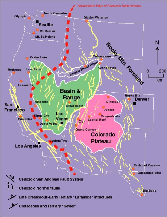
Tectonic Map of western United States
The bold red line marks the approximate edge of
Paleozoic North America
More Explanation below map.
This map outlines the principal differences in the bedrock geology and geologic history of much of the western U.S. The Colorado Plateau, for example, is a region marked by relatively undeformed rock--so the landscape is dominated by flat-lying rock. Similarly, the Basin and Range Province, because it has experienced crustal extension during much of the Cenozoic, is cut by numerous normal faults. Those normal faults have uplifted a whole series of parallel ranges, each of which is separated by a down-dropped basin. By contrast, the Sevier fold-thrust belt is a narrow belt of crustal contraction, so there, the rock is folded and thrusted.