EXERCISE 3.5
TERRAIN MODEL
USING LINES AT VARYING ELEVATIONS
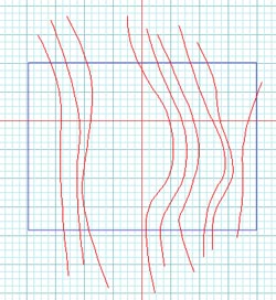
1. Draw a set of contour lines.
2. Make a steep embankment at the back
of the site:
-
Turn the "Z snap" on
 .
.
-
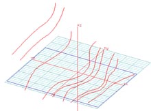
Use the MOVE tool to place each contour line at
a different height.
-
Double click on the TERRAIN tool.
-
Select USE CONTOUR HEIGHTS.
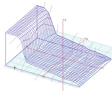
3. Select the rectangle, and a model
using your predetermined heights will be generated.
NEXT/INDEX