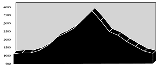
Castle Rock ride is geared for bicyclists who want an aerobic climb and an outstanding view as a reward for reaching the top. To reach the summit, the rider must be prepared for a significant climb of approximately 2700 feet.
Start the ride at Delta Campground located on the north end of Road 19. See McKenzie River Drive for directions to the campground. From the campground, proceed south along Road 19 for about 0.5 miles. Here Road 19 forks; bear left and take Road 410. In another 0.5 miles take a left on King Road 2639. Continue pedaling for 1 mile until you reach O'Leary Road 480. O'Leary Road will take you the 5.8 miles to the Castle Rock trailhead. Castle Rock was probably so named because of its cone shape, which resembles a fortress or castle that overlooks much of the upper McKenzie Valley. Several Forest Service lookouts have occupied the mountain top since 1917.
The trail to the summit is 1 mile. The spectacular view from the top reveals The Three Sisters Wilderness, the McKenzie River valley, and the coastal range on the western horizon.
Martha Moran
Printer Friendly Version