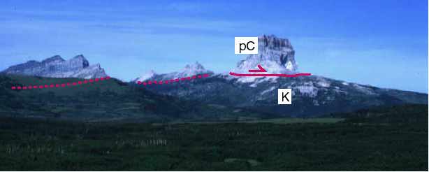
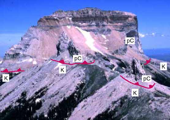
Views of Chief Mountain.
In both photographs, the red lines mark the Lewis Thrust fault. pC stands for rocks of the PreCambrian Belt Supergroup; K stands for Cretaceous rocks.
Return to Map Patterns